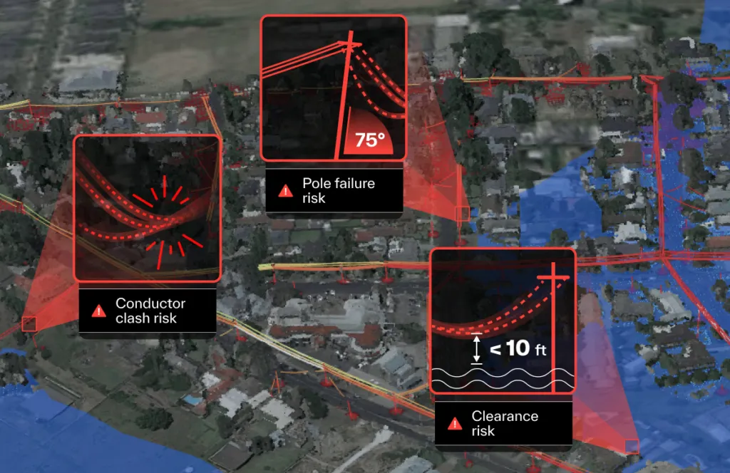
Traditional equipment inspections have three fundamental problems: they’re slow, they miss things, and they’re inconsistent. Field teams can cover only a few hundred poles per visit. A leaning pole at risk of failure can appear upright to the naked eye. And human inspectors struggle to maintain precise, consistent thresholds across thousands of assets.
This primer explains how digital equipment inspection addresses all three—not by replacing field work, but by transforming how it’s targeted and prioritised.
Using geospatial data (LiDAR, imagery) combined with physics-enabled digital modelling, utilities can:
- Inspect entire networks simultaneously—covering assets that field teams won’t reach for months or years
- Simulate extreme weather scenarios—identifying assets that are within tolerance today but vulnerable under stress
- Apply consistent, objective risk thresholds—eliminating the relative judgment bias that creates inconsistency across large asset populations
- Generate defensible documentation—for regulators, insurers, and internal stakeholders
The result is a smarter inspection programme that sends field teams where they’re actually needed—and keeps crews away from unnecessary visits.