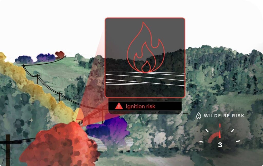
Addressing visible vegetation risks and sticking to a schedule might have passed muster in years past, but with your partners’ vegetation programs under a critical microscope, long-term winners are showing utilities how to solve tomorrow’s risks instead of just today’s. Supercharge your deep expertise with a digital network model augmented with context from multiple data sources, from LiDAR to satellite imagery, that empowers you to pinpoint where vegetation will become a problem when the weather turns on a dime or when equipment fails.
- Take on larger, more predictable vegetation engagements by knowing when vegetation will graduate from a risk to a full-blown hazard via growth dynamics or severe weather and tier field operations accordingly
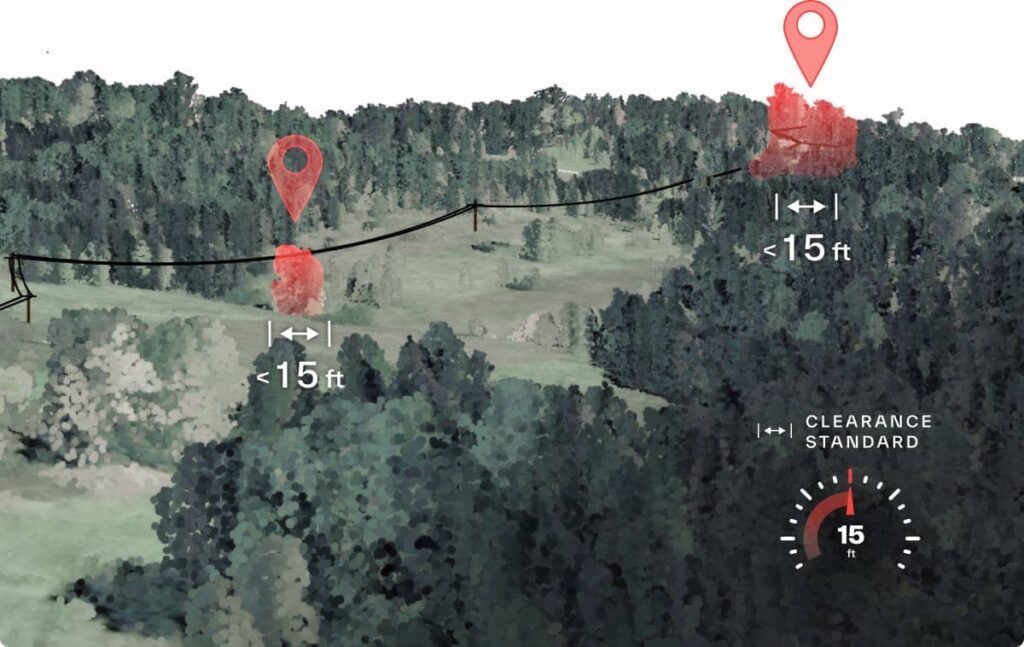
- Tailor vegetation management programs at scale no matter how different one partner’s p1 encroachments look from the next and ensure your risk categorization is consistent with your partners’ standards and showcases your expertise in each partners’ network nuances
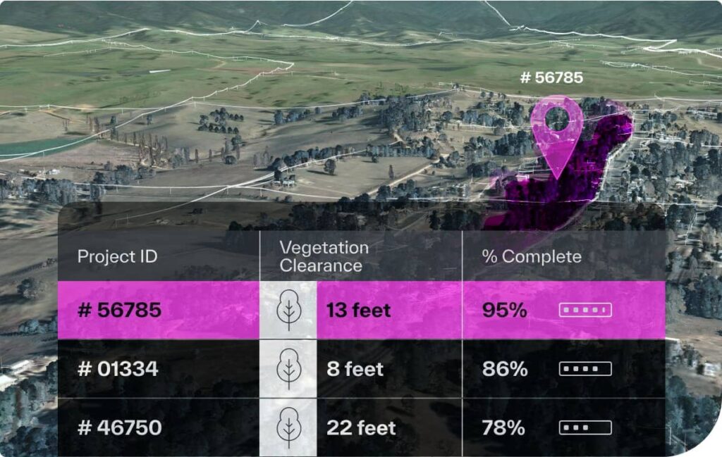
- Next-level project management means you can answer any status question at a moment’s notice with pinpoint precision as well as quantify your impact
Not your average vegetation program
Tried and true — not one-size-fits-all
A flexible vegetation risk model augmented with your unique expertise is a powerful, context-rich combination that keeps the projects coming. Whether you work with co-ops in high-fire threat districts, munis with stricter clearance standards or large IOUs in hurricane zones, you know each partner’s network features a laundry list of nuances your program needs to reflect. Simulating these variables in our digital network model is your most powerful ally in scaling your expertise to help every utility get ahead of any vegetation hazard.
More projects, less project management
Bid on more projects without the extra project management overhead. Running your projects from your digital network model means you have an up-to-date view of the maintenance or construction status on every project at your fingertips — no more scrambling for anecdotal updates, making it a breeze to answer status questions from partners. Plus, it means you can keep your projects securely partitioned and maintain a birds-eye view of all of your projects to help answer the internal questions too. No per-seat fees means everyone who needs to stay in the loop can with a shared, consistent, audible view of your projects.
Don’t let unpredictable vegetation derail predictable engagements
When you’re the authority on anticipating when vegetation will become a problem, you’re the right team for the job. Look no further than a digital network model to help reveal the weather conditions and growth patterns that are likely to require maintenance under a range of simulated scenarios. Delivering a data-backed, stress-tested, long-term vegetation roadmap means a predictable partnership for you and the utilities you serve, resulting in less contractual red tape and more efficient operations and resource allocation.