LiDAR & GIS Reconciliation
Your operations are only as strong as the data you rely on — inaccurately documented assets can create serious hazards that catch you off guard. Combining accurately classified LiDAR with your GIS records and other data sources generates a powerfully accurate network model. Confidently navigate everything from life-saving decisions to major grid hardening investments across every corner of your network.
- Use LiDAR to identify and solve for GIS discrepancies – understand your network’s vulnerabilities, and find the best pathways to resilience and decarbonization
- Understand more than just where your assets are located and remotely diagnose standard compliance issues
- Reduce faults with data-driven decision-making across the entirety of your network, not just the well-documented parts
A blueprint to inform your most important decisions
Save your efforts for real-life risks, not data issues
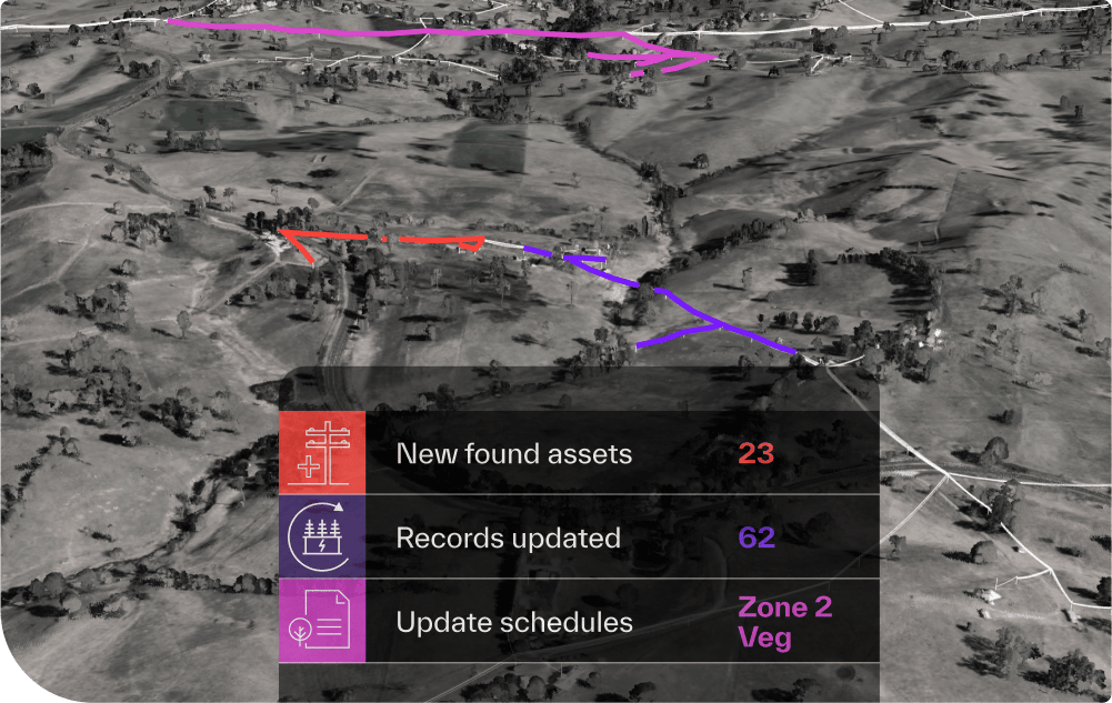
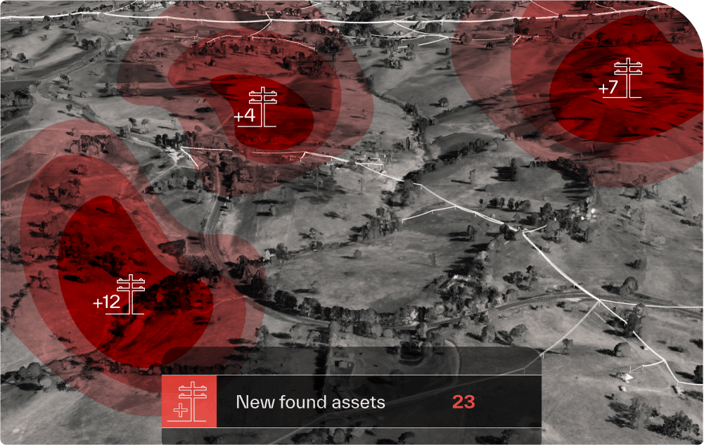
Know your network like the back of your hand, and don’t let undocumented assets derail your carefully planned operations. Our model uses a proprietary topological fit function to identify and catalog unknown assets with unparalleled accuracy – it models asset distribution, proximity to topological variables, and logical characteristics such as asset type and purpose. Stay in control, and don’t let at-fault assertions throw a wrench in achieving your objectives.
A single source of truth to direct your operations
Remove unnecessary friction and keep your GIS records up to date. Using your network model, you’ll be able to sanity-check your GIS against high-quality LiDAR scans and other data sources, like satellite imagery and asset libraries. Avoid headaches from sending field crews out to the wrong locations – not to mention time and cost. Handle complexity with confidence, and upgrade paper processes with a clean, consistent source of truth.