
Resources
How To Avoid Vegetation-Related Outages and Incidents – Without More Field Visits
Resources
A primer on digital vegetation inspections and risk-based vegetation programs.
Your team has seen just about every tree in your network. You can rattle off every local vegetation species ranked in order of growth speed, fuel structure, and how many headaches it causes. You can pattern-match any root depth and ground slope combination and call fall-in risks on the spot.
So when your proposed vegetation management plan comes back to you smothered in red tape, what gives?
No matter where you are, the stakes have never been higher. Vegetation is at least partially responsible for 70% of blazes, which we’re seeing even across non-traditionally wildfire-prone parts of the world. And when vegetation isn’t at risk of igniting, it’s causing outages — it’s not uncommon for vegetation to take the blame for two-thirds of all outage events.
And while the stakes have never been higher, the costs of a robust vegetation management plan are climbing in tandem. Vegetation has always been a lumpy rate case line item, and rate requests across US utilities have just set a third consecutive record.
It’s clear that the industry needs more rigor across vegetation practices, but we can’t afford rigor at any cost. Forward-thinking utilities are embracing digital-first vegetation surveys, saving highly targeted risk-based vegetation inspections for the field to scale their team’s expertise across their entire network.
See how one utility is completing vegetation work 50% faster
Vegetation doesn’t stick to a schedule
When you’re responsible for hundreds of thousands of trees and a given field inspector can only examine up to 100 at a time, scheduling manual field inspections can feel like a perpetual reactive feedback loop. Even the deepest expertise can only cover so much ground at once. And perhaps the biggest challenge lies in the “schedule” itself.
No matter how thoughtful and well-architected your field inspection cadence is, you know better than anyone that vegetation doesn’t stick to a schedule. Unseasonably cool and warm temperatures, increasingly unpredictable rainfall patterns, and flooding further muddy the waters. Send field teams out too soon, and you’ve wasted valuable time and resources. Send them out too late…and at best, you’ve got an outage. At worst, you’re fighting a fire.
Digital inspections put you in control.
While you can’t control the weather, there are many variables you can control to strengthen your vegetation program and the proposal behind it. The key to unlocking that control is a digital version of your network that behaves exactly as your real-life assets do in the field.
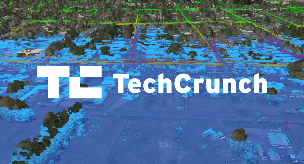
AI and digital modeling technology have evolved to deliver a hyper-realistic environment for conducting network-wide vegetation inspections remotely. A combination of data sources such as GIS, LiDAR, and satellite imagery set the record straight on exactly how your assets exist in the field relative to vegetation risks.
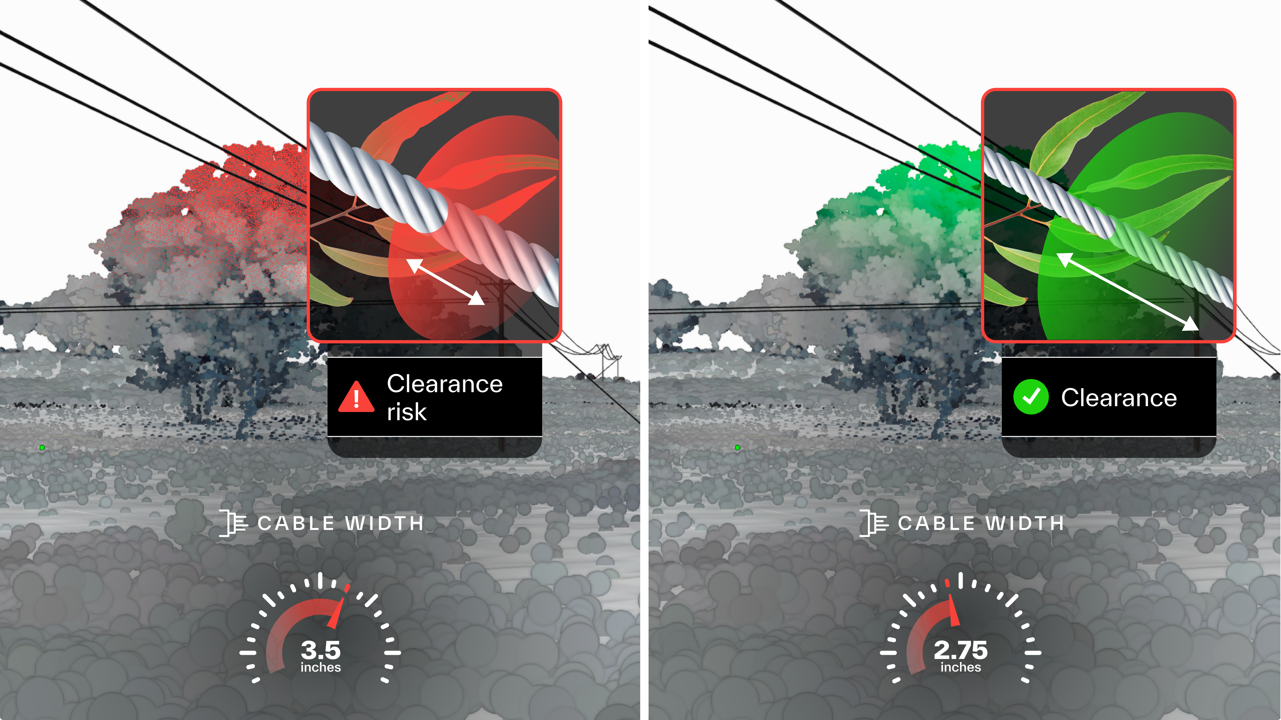
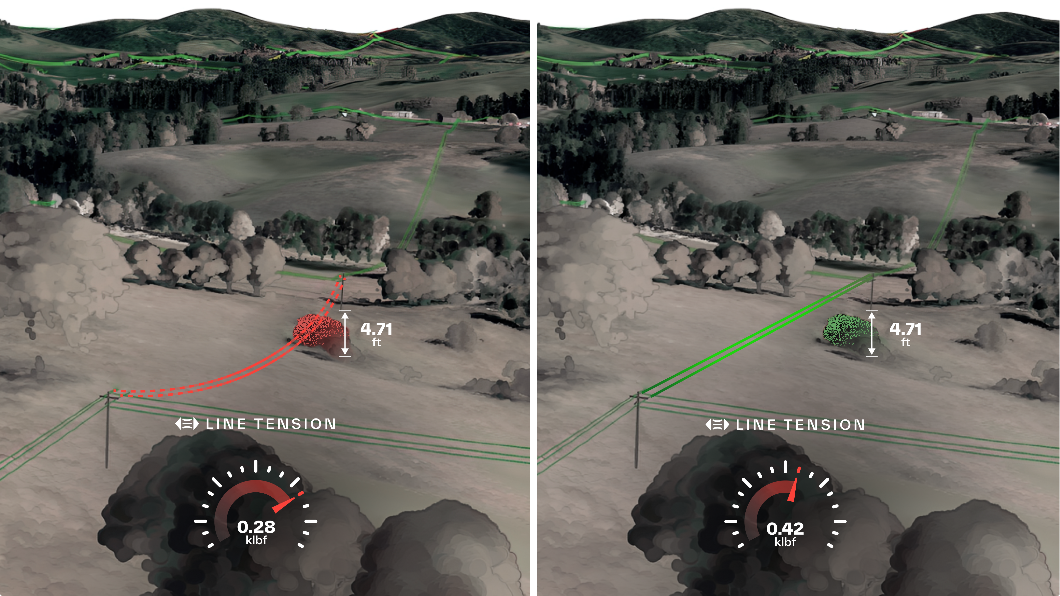
The best digital network modeling software automatically reflects the precise clearance measurements you need and puts them right at your fingertips so you can make better, faster decisions. It automatically measures the distance between a 3.56” slack cable and a nearby Eucalyptus tree, between 4.71 feet high underbrush and under-tensioned broadband wires above, and can distinguish between dense, overlapping Oak tree canopies above or underneath a line.
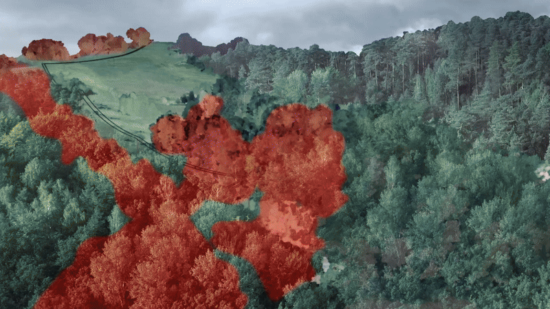
Analyzing your entire network results in consistent risk definition because your model ensures that you factor in the whole of the relevant sample and assign risk scores on a relative basis. The outcome? Every “P1” is actually a P1. It’s not uncommon to randomly sample several manually flagged “P1s” and note many that don’t quite make the cut. And among those that do, there’s often a great deal of variability in actual urgency — if your “P1” threshold is an eight-foot clearance, you probably want to prioritize the one that is one inch from a line instead of 7.9 feet away.
More importantly, consistent risk definition also prevents unflagged “P1s” from slipping through the cracks — meaning you can complete vegetation work in order of priority, not just proximity.
The first variable you’re now able to control is consistency. Regular vegetation inspections in a digital network model is like having your best field inspector out at all times, covering every tree in your network in a single session. As such, digital inspections remove the inevitable variability across different inspectors’ “guesstimations,” introducing a new precision threshold across all field operations.
Network-wide scale combats the Red Queen Effect.
The second variable you can control is how much ground you will cover at once. One of the hardest parts of vegetation management is that wire-downs and wildfires don’t care if you just wrapped up a painstaking inspection cycle across 97% of your network if there’s room for them to wreak havoc in the other 3% you haven’t gotten to yet.
But the reality is that most vegetation teams only have the resources to inspect ~25% of their networks using traditional approaches. Many vegetation teams have suffered a Red Queen Effect where even as they spend more time in the field, their best efforts barely move the needle on SAIDI / SAIFI and wildfire risk. Many vegetation teams default to reactive mode because they don’t know what they need to prioritize if they don’t know what the next circuit, or the one after that, holds.
Outages, wire-down, and wildfire risks are not spread evenly by circuit. So, when you have a limited budget to go around, how can you be sure you’re focused on the risks that matter most?
Clicking through a digital model interface is a much lighter-weight approach to cataloging and exploring risk zones than having a crew travel entire lines, covering a small fraction of what you can see from your desktop. When you also count on that team to continuously improve your pruning program, and instead, they’re stuck manually collecting data, it’s easy to see diminishing returns on more field visits.
Digital modeling technology allows you to automatically generate clearance reports before going into the field. This way, your team can focus on strategic approaches to addressing vegetation.
Dramatically increase the speed of your vegetation clearance reports
Bring dangerous situations to life in a controlled environment so you’re ready for the real thing.
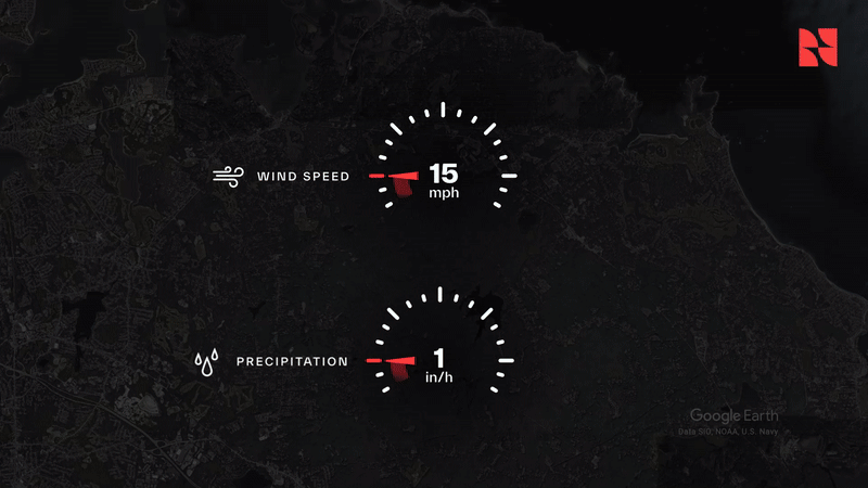
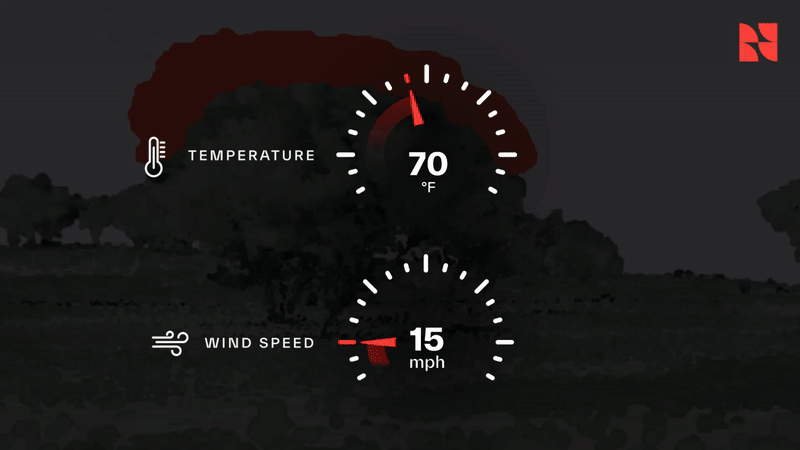
You would never send an inspection team out in gale-force winds to get an up-close view of fall-in risks. Or have them change line tensioning so much to the extent that a live wire falls on the ground and ignites underbrush. But at the same time, it’s more important than ever to understand how vegetation will interact with your equipment in increasingly common dangerous scenarios. So, how do you build a confident, tangible understanding of risks without putting your team in danger?
Safety is the third variable you can control using a digital network model to facilitate vegetation inspections. A digital network model not only replicates the as-surveyed conditions you’d see in the field — but when equipped with predictive AI capabilities, it offers a controlled simulation environment where you can bring any set of conditions to life in your model and see exactly how your field assets and surrounding vegetation will respond in real-time.
This way, you know exactly which P1 encroachment risks will rear their heads next time a >60 mph wind rips through your network. You’ll know exactly where your clearance breaches are the next time temps exceed 90 degrees and your lines sag five feet closer to underbrush than they did in the last field survey. You can triage these risks proactively, letting data-driven prioritization guide your team instead of the legacy schedule.
Remote inspections via a digital network model substantially increase the thoroughness and accuracy of your vegetation inspections, infusing them with predictive power while saving thousands of unnecessary field visits a year — and the truck rolls, safety incidents, and customer complaints they entail.
Inspect every tree in your network with one click
Prioritize risks the way your best inspector would, not the way that legacy logistics allow.
With the tools to support consistent risk definition criteria across your entire network in any set of weather or equipment conditions, your team can prioritize and address the risks the way your most seasoned inspector would — rather than settling for what logistics have forced you to accept.
You and your team design the risk criteria and mitigation approach, and the model helps enforce them. The only difference is that now you can control variables you otherwise cannot, giving you the flexibility to stress-test and seamlessly evolve your criteria as you rise to meet today’s challenges. Most importantly, you now have hard data to guide and defend your most challenging prioritization decisions.
Delegate the clearance report generation heavy lifting to your digital model, and then your team is free to focus on identifying the most environmentally friendly, community-friendly, and cost-effective pruning approaches. It’s finally time to trade on the ideas your team has been pushing for years but weren’t practical to implement.
Digital network modeling scales your team’s expertise across your entire network instead of the small pockets of vegetation they’re otherwise able to address at once. When it’s time to go into the field and determine the best mitigation approach, the model also helps ensure that inspectors know exactly where to go. Imagine your teams no longer at the mercy of outdated GIS maps manually spot-judging which trees have an 8-foot or 8.1-foot clearance along a 300-yard stretch of line with sundown fast-approaching.
When your vegetation clearance reports are durable, digital artifacts instead of papered work orders with the lifespan of any given trim job, your team can work more effectively together, resulting in a whole output greater than the sum of its parts. Every vegetation stakeholder knows what constitutes a P1 risk, the exact locations of each, and the work order status, creating a new standard of consistency and transparency that gives you the breathing room to do things your way.
Your vegetation team — a multi-stakeholder center of excellence.
Remote vegetation inspections help align your vegetation team from within. Moreover, the data exhaust your digital-model-grounded operations generate becomes the currency that improves coordination with everyone from other field teams to environmental groups and regulatory agencies.
When your equipment inspection team replaces a pole with a slightly taller one, that change and its impact on clearance should ripple through your digital model—instead of waiting months for that work order to cross paths with your field survey and sending a team to inspect a risk that has either worsened or no longer exists.
When your regulator is skeptical of your vegetation budget ask, your digital model allows you to double-click and show your work with ease. You can show all of the P1 risks you’ve identified, explain the criteria and cite the locations, and then match the cost of the approach your team has identified to each one. Because you have more runway to address risks, chances are you’ll also be in a better position to negotiate contracted rates.
When environmental groups are concerned about vegetation operations, all you have to do is show them the risks and how you’ve defined them in the model. With the model as common currency, aligning on an approach all parties feel good about is much easier. Modeling technology means no reason to pit good environmental stewardship and safety against each other.
Powerful digital modeling technology will help you transition to risk-based field inspections that drive substantial improvements in SAIDI/SAIFI, reduce wire-downs and wildfire risk, and save thousands of field visits annually. Don’t let your team get held back through another storm season, wildfire season, or ratemaking cycle.
Reach out. We’re very friendly.
Contact us to learn more, schedule a demo, inquire about a pilot project, or discuss other needs.